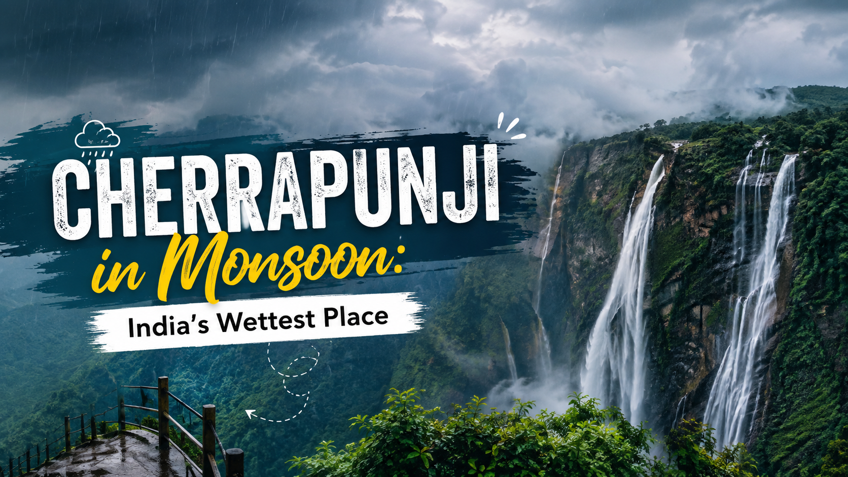
Cherrapunji in Monsoon: India's Wettest Place
When you ask anyone about the wettest place on earth, you will most likely hear about Cherrapunji. This little town in Meghalaya has held that distinction for over a century, and frankly, when you’re there in the midst of a July downpour, you can see why. If you are searching for monsoon destinations in India for this year, put Cherrapunji on top of that list. This is everything you should know before you visit: how the town got its reputation, what causes all that rain, how the weather changes throughout the year, and the places and experiences that make a monsoon trip here worth planning.
History of Cherrapunji
The locals don’t really call it Cherrapunji. The original name is Sohra, but the one Meghalaya officially brought back a few years ago. During the days of the British Raj, the British renamed it Cherrapunji and somehow that name has outlasted the empire itself, staying put for more than a hundred years.
The town is located in the East Khasi Hills, the homeland of the Khasi people, one of North East India’s oldest tribal communities. Some clever adaptations had to be made, living with this much rain for generations - how houses are built, how farming is done, even those famous living root bridges. Nothing about this was accidental.
Here's another lesser known fact: the British actually made Cherrapunji the administrative capital of the Khasi and Jaintia Hills at one point. Made sense on paper - good location, strategic hills. Didn't work out in practice, though. Running an administration through months of nonstop rain proved difficult, so the capital moved to Shillong, which gets noticeably less rainfall. Cherrapunji lost the administrative title but kept its place in the record books.
Why Is Cherrapunji So Wet?
Let’s get right to it, because everyone asks this sooner or later: it’s geography, not luck.
Cherrapunji is on the southern edge of the Khasi Hills plateau, facing the Bay of Bengal directly. During monsoon season, the winds pick up huge amounts of moisture over the bay and travel north over the flat lowlands of Bangladesh - not much to slow them down. Then they reach the Khasi Hills and suddenly there is a wall of steep terrain blocking the way.
The winds are pushed up, nowhere else to go. Warm air is good at holding moisture, and when it cools, it can't hold the moisture and almost at once it becomes clouds and rain. This is called orographic rainfall, and it's the single biggest reason Cherrapunji sees so much water year after year.
A couple of other factors play a role too:
The town is at just the right height for this rising-air effect to be very strong - at about 1,290m above sea level.
Mawsynram nearby beats Cherrapunji in some years of rainfall partly because of an almost funnel-shaped landscape.
There is very little land between the Bay of Bengal and these hills to break up the wind, so it comes here still carrying most of its moisture.
Cherrapunji's Rainfall Records
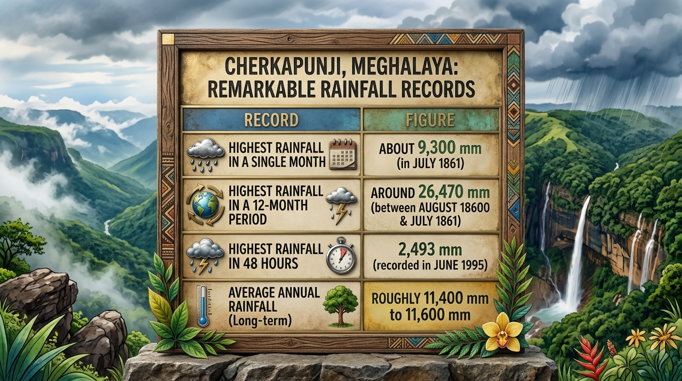
Some of these numbers sound made up until you see where they come from.
For context, plenty of Indian cities get their entire year's rainfall total in what Cherrapunji sees over a few days. The World Meteorological Organization recognises these records, and per Britannica, Cherrapunji still ranks among the top two wettest spots on the planet, running a close race with Mawsynram nearby.
One thing to mention - rainfall is down a lot here compared to the 1970s. Older people remember winters when there were light showers as well, which is rare now. Still, this place is wetter than just about anywhere else on the planet.
Weather in Cherrapunji Through the Year
There are different versions of Cherrapunji, depending on when you visit.
Monsoon season (June to September): Almost all the rain comes now. Look for gray skies, mist rolling in heavy and rain that just won't stop for hours on end. This is also when the waterfalls are at their loudest and fullest.
Winter season (November to February): But the drought. The rain has almost stopped and, ironically, water shortages have become a real problem for the locals these months - strange considering the town's reputation.
Spring and early summer (March to May): Here and there pre-monsoon showers start appearing, the weather turns pleasant and everything starts greening up again ahead of the main season.
What Makes Monsoon So Special in Cherrapunji?
Here, monsoon is not just another season - it is the reason the place is famous. Some things are noticeable:
Waterfalls at full power: Nohkalikai and Seven Sisters seem like completely different places than in the dry months. What’s a trickle in winter becomes a roaring wall of water by July.
The root bridge: are at their prime, streams beneath them run full, and the forest around them is a deep, saturated green.
Clouds drift at eye level: Due to the altitude, clouds often pass right thru the town itself - truly feels like walking through the sky at points.
Far fewer tourists: Monsoons keep most travelers away, which is good news for you – quieter roads, easier bookings, less of a crowd at every stop.
Best Places to Visit in Cherrapunji
Planning to see more of the state while you're here? This Meghalaya backpacking itinerary covers Cherrapunji alongside Shillong, Dawki, and Mawlynnong, so you're not just sticking to one town.
Nohkalikai Falls
One of India's tallest waterfalls, dropping from well over 1,100 feet. Monsoon is when the flow hits its peak, and the viewpoint is barely a short walk from where you park.
Living Root Bridges
The Khasi people grow these by training rubber tree roots across streams - a process that takes years, sometimes decades. The double-decker root bridge near Nongriat village gets the most visitors, and it's easy to see why once you're standing on it.
Seven Sisters Falls (Nohsngithiang Falls)
Seven waterfalls running down the same cliff face at once. In monsoon, all seven are usually active together, which makes this one of the most photographed spots in the whole region.
Mawsmai Caves
Need a break from the rain? These limestone caves are well lit and easy to walk through - no technical climbing skills required.
Dainthlen Falls
Quieter than the big-name waterfalls on this list. Worth a stop if you'd rather skip the crowds.
Thangkharang Park
On a clear day, you get wide views stretching out toward the plains of Bangladesh, plus a smaller waterfall tucked inside the park itself.
Things to Do in Cherrapunji
Trek to the double-decker root bridge: The route from Tyrna village down to Nongriat runs close to 3,500 steps. It's not easy, but the bridge at the end makes the effort worth it.
Explore the limestone caves: Both Mawsmai and Krem Mawmluh are worth setting aside time for if caves interest you.
Visit a local Khasi village: Worth slowing down for - seeing firsthand how the community has built its homes and farming methods around extreme rainfall.
Try local Khasi food: Look for jadoh, a rice and meat dish that's a local staple, along with fresh oranges and pineapples grown right in the region.
Just watch the clouds roll in: Sounds simple, but sitting at a viewpoint and watching clouds move through the valley is one of those things you'll remember long after the trip.
How to Reach Cherrapunji
By Air: Guwahati is your nearest airport to Cherrapunji, roughly around 170 km away. From there, you can grab a cab or shared taxi toward Shillong, then continue on to Cherrapunji.
By Rail: Guwahati again is the closest major railway station, it is well connected to the rest of the country.
By Road: Cherrapunji sits about 55 to 60 km from Shillong, and most travellers base themselves there before making the trip. For the full route breakdown, check this Delhi to Meghalaya travel guide.
Practical Tips for a Cherrapunji Monsoon Trip
Carry an actual raincoat, not an umbrella - the wind here makes umbrellas pretty useless.
Wear waterproof shoes with solid grip, especially if the root bridge trek is on your list.
Keep your phone and camera in a dry bag or zip-lock pouch at all times, not just when it's actively raining.
Build in 1 to 2 buffer days for possible road delays.
Book homestays ahead of time - they tend to offer a better, more local experience than standard hotels here.
Conclusion
Cherrapunji's reputation isn't hype - it's backed by real numbers and a geography that has shaped the town for centuries. Monsoon is when all of that comes together: waterfalls running at full strength, root bridges wrapped in green, clouds moving through the streets like they belong there. If you want a monsoon trip that doesn't feel like every other hill station visit, this one's worth the extra planning.
FAQs
1. Why is Cherrapunji called the wettest place on earth?
Its location on the southern slope of the Khasi Hills forces moisture-heavy monsoon winds to rise quickly, triggering heavy rainfall through a process called orographic rainfall.
2. What is the old name of Cherrapunji?
Sohra - that's the town's original local name, which Meghalaya officially reinstated in recent years.
3. Which month gets the highest rainfall in Cherrapunji?
July typically sees the heaviest rain, with the town once recording close to 9,300 mm in July 1861 alone.
4. Is Mawsynram wetter than Cherrapunji?
In several recent years, yes - Mawsynram has recorded slightly higher average rainfall, though both remain among the wettest places on earth.
5. Is it safe to visit Cherrapunji during monsoon?
Generally yes, as long as you track weather updates, skip trekking during heavy rain alerts, and build buffer days into your plan for possible road delays.
6. How many days are enough for a Cherrapunji trip?
2 to 3 days is usually enough to cover the main waterfalls, caves, and a root bridge trek without rushing.